VirtualAirBoss to Coordinate UAS on the IPS Mobile Communications Center

(PRWEB) December 31, 2014 -- SmartC2 announces that its VirtualAirBoss™ software will help coordinate communications with UAS and other equipment on the MCC, a fully interoperable Mobile Command Center offered by Information Processing Systems (IPS) out of San Carlos, CA. MCC provides robust and affordable emergency communications solutions to the first responder community across the country.
The “VirtualAirBoss software will significantly enhance the ability of our MCC to achieve interoperability with the multiple government and industry organizations who coordinate response to disasters across the country," according to Clarence Boice, CEO of IPS. "There is a tremendous amount of data that needs to be managed to enable different groups to effectively respond together to emergencies, and VirtualAirBoss provides an easy way to create a common operating picture from all that critical data. And even more important, it can help retrieve that information after the fact for lessons learned, after-action reporting, and reimbursement.”
According to Stuart Rudolph, SmartC2 President and CEO, the "VirtualAirBoss was designed explicitly to manage operations like the MCC with all of its communications components. We invented the VirtualAirBoss to help aviation business owners manage their business end to end. Emergency management has all the components of a small aviation business, and complex business processes spanning the beginning to the end of the mission, right through to invoicing for services provided.” This is just as important for operating manned or unmanned aircraft (UAS), communications, and all of the MCC’s mission-oriented support equipment. Business owners also need to serve their mission while keeping track of all the flight details, plus the equipment and maintenance, crews, and various payloads. There’s a tremendous amount of data to organize and keep track of to stay safe, remain profitable and operate in compliance.
Using VirtualAirBoss on the MCC means that everyone involved can stay up to date on whatever is happening, and what is needed, where. This fills a huge communication gap when all the different agencies and organizations who have responded are trying to do the right thing and save lives in emergency conditions. Rudolph continues, “We are thrilled that IPS and Clarence see the value in an VirtualAirBoss as an easy to use software solution to manage their communications and coordination challenges in the field.”
About SmartC2: SmartC2 was founded by seasoned entrepreneurs dedicated to providing VirtualAirBoss software and services to manage light commercial aviation businesses end to end. Headquartered in Grand Forks, ND, SmartC2 draws on the highly skilled workforce graduating from the UND School of Aerospace, and personnel associated with the nearby Grand Forks AFB. SmartC2’s VirtualAirBoss software is dedicated to helping light commercial aviation businesses serve a wide variety of industries with manned and unmanned aircraft (UAS) for hire. All types of aircraft need to manage a huge amount of data related to crew, equipment and payload in order to fly safely, profitably and in compliance. VirtualAirBoss is software designed specifically to manage all the data generated by aviation businesses end to end.
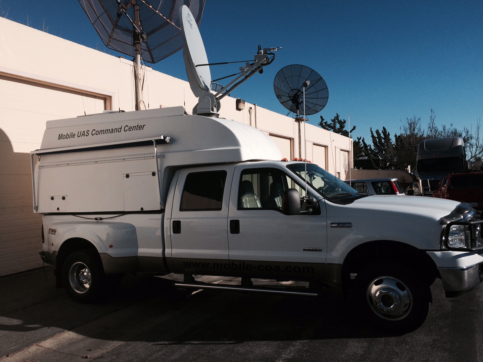
About IPS: IPS is proud of its 44-year history of providing market-changing solutions in the global sensor fusion and mapping industry,” said Clarence Boice, CEO of Information Processing Systems, Inc. “IPS has been a leader in the market for decades both as a strong partner of the DOD and DHS; as well as many international commercial companies as a provider of critical information and a supplier of world-class information solutions.” Today IPS offers the MCC (a Mobile Command Center) that provides a central data gathering point for today's subsurface, ground, unmanned aerial, and manned aviation inspection, observation, and reconnaissance sensors. The MCC is mobile to go wherever disaster has struck. The MCC includes a fully interoperable communication system, a GIS mapping platform, as well as multiple high-speed data networks, and back-haul satellite network capability. Rotary Wing and Fixed Wing Unmanned Aerial Vehicles (UAVS) can be quickly deployed with high resolution cameras, CBRN sensors, LiDAR, and Geospatial capabilities. These images and data are wirelessly transmitted back to the MCC, and can process in a GIS information system. The MCC can also carry the Smart Tactical Advanced Communications System (STACS), a portable light weight, interoperability communications system, that will work virtually anywhere, any time in the world, regardless of existing infrastructure. The STACS weighs under 15 pounds in the case with accessories, battery power, data and voice over IP (VOIP), Radio over IP (ROIP); and WIFI for internet connectivity.” Wherever and whenever disaster strikes, IPS products and services can help.
Janet Ahlgren, SmartC2, +1 617-799-3131, [email protected]
Share this article