Obstacles to Progress: SmarTopo Harvest Develops a Safe Zone for Drones

Albuquerque,New Mexico (PRWEB) March 29, 2015 -- Rapid Imaging Software, Inc. is introducing SmarTopo Harvest on March 30, 2015. This new technology is integrated into the SmarTopo Obstacle Management System. SmarTopo delivers obstacle survey and detection technology plus powerful data management tools for a complete obstacle management system. SmarTopo is certified by the Federal Aviation Administration (FAA) to a level 1B.
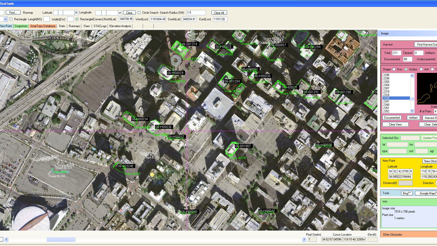
SmarTopo Harvest is the latest obstacle detection technology from Rapid Imaging Software. The software provides a fast and efficient method to detect undocumented obstacles and add new obstacles to a database.
SmarTopo Harvest:
1. Searches for obstacles – the height for the search is set by the analyst
2. Detected objects or structures may be compared to the FAA obstacle database
3. Estimates height of the objects or structures
4. Creates new obstacle for a proprietary database
The issue of undocumented obstacles is extensive. A recent study conducted using SmarTopo Harvest indicates there are a substantial number of undocumented obstacles in the national airspace. An analyst using SmarTopo Harvest identified 52 undocumented obstacles of 200 feet or more in a study area of six square miles around the Los Angeles International Airport.
Mike Abernathy, Director of Development notes, “SmarTopo Harvest is the key for small commercial drones to operate safely in urban areas. This technology allows companies to create and maintain an obstacle database for their drone operations”. For more information visit: http://www.rapidimaging.net/obstaclemanagement/.
Leslie Clark, Rapid Imaging Software, Inc., http://www.rapidimaging.net/obstaclemanagement/, +1 608-824-1131 Ext: 102, [email protected]
Share this article