3D Wall Maps for the Wine Industry: Summit Maps Expands Custom Map Offerings

(PRWEB) January 13, 2017 -- Summit Terragraphics (http://www.summitmaps.com), creator of precision raised-relief maps, is expanding its custom offerings to include custom 3D wall maps for the wine industry. Recent custom projects have included maps of the Dry Creek Valley AVA, Daou Vineyards and Winery in the Adelaida District, and the Yamhill-Carlton AVA in Oregon. Similar projects are underway for other locations.
The Dry Creek Valley map project yielded a 10” x 16” geophysical relief map, with copies used as portable reference and promotion pieces for the Winegrowers of Dry Creek Valley.
For the Daou Vineyards project, the winery owners wanted to show the position of their vineyard within the AVA. (Daou is the highest elevation vineyard in the Adelaida District.) The 20” x 14” Daou relief map includes a 3D inset map that identifies the vineyard blocks by grape variety. The main map graphics also show the path of ocean winds that bring cool moist air from the Pacific up into Daou’s mountaintop growing area.
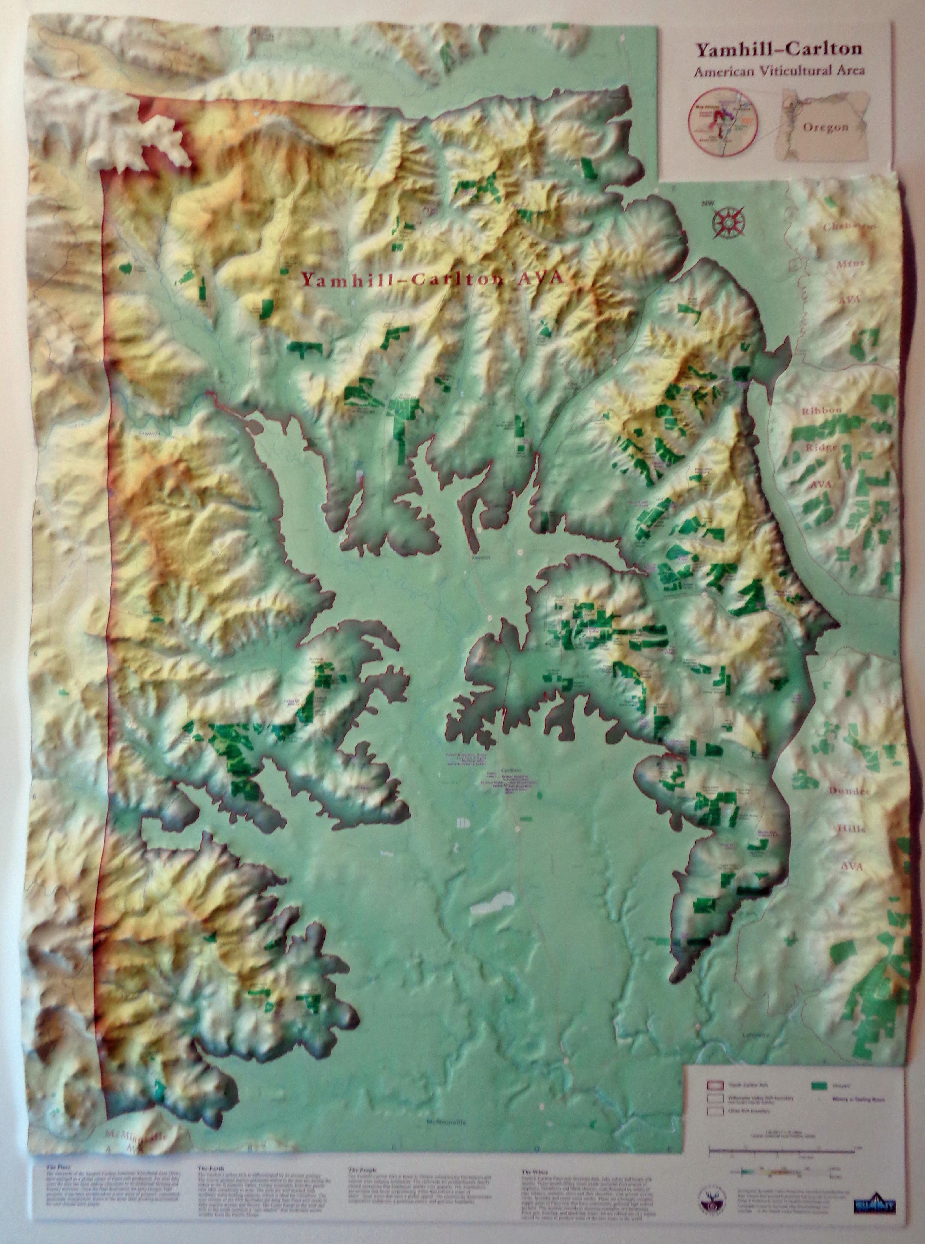
The colorful Yamhill-Carlton AVA raised-relief map is approximately 42” x 30” and uses both molded relief and a color elevation ramp image to emphasize changes in elevation. It shows the entire AVA and identifies the property lines and name of every vineyard in the AVA, as well as roads and natural features.
About Summit Terragraphics Inc.
Summit Terragraphics was established in 2007 with the goal of redesigning traditional raised-relief maps for greater precision and image resolution, taking advantage of the latest digital technology and a proprietary tooling process. The result has been the creation of attractive and extremely accurate maps for industry, government, and recreational use.
In addition to its custom maps, the company’s full product line includes a variety of regional earth image maps, National park maps, 3D aeronautical charts, and several specialty maps – including a 3-D map of the Island of Kauai and one of the entire Appalachian Trail from space.
Michael Higgins, Summit Terragraphics, http://www.summitmaps.com, +1 304-274-0978, [email protected]


Share this article